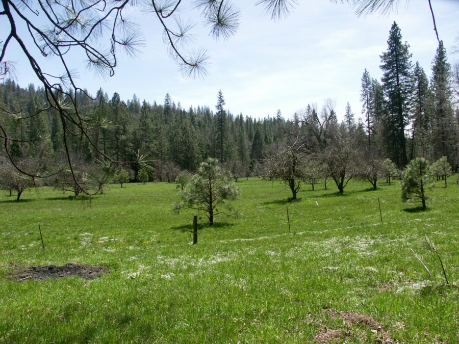
This photo shows (click on the image for larger view) an area on private property owned by the author's family where the author has practiced mechanical thinning (not supplemented with prescribed fire) for over thirty years. This area has been kept mechanically thinned since 1990. (Thinned biomass was piled and burned.) Before the author started this thinning project, incense cedars (
Libocedrus decurrens) and small ponderosa pines (
Pinus ponderosa) up to twenty feet tall were so thick, it was impossible to walk through this area (a condition unfortunately still predominating thoughout hundreds of square miles in the surrounding forest). The small cedars visible in the foreground are about 5 years old. If allowed to grow unchecked for ten years, with the addition of new seedlings which literally carpet the ground every spring, these trees would choke the area, competing for sunlight, nutrients, and water. Periodic application of prescribed fire used by Native Americans in the old days (before about 1
850) killed most of the young growth and kept the area more or less as it appears in the photo (see photo below).
The below National Forest Service photo (click for a larger view) shows a view in the Tahoe National Forest in 1911. It is not a local photo, but it reminds the author of his grandmother's descriptions of the local forest with which she was familiar in her youth (1905-1915). She described that forest as easy to walk or ride a horse through.


 This photo was taken April 8, 2012 at approximately the 3800 foot elevation on Peterson Road near Blue Canyon in eastern Fresno County.